
Greetings Me Droogs N Droogettes!
Long time ago, in an Army far, far away, there was a LT…
With a Map, and a Compass…

Sadly, it did not end well for that young Lieutenant.
As it well may be for the rest of y’all if you don’t get your shit straight for when the day comes.
Everybody, and I mean everybody… every swinging Richard out there has gotten faaaaar too comfortable with their Phone and iGizmos and whatnot in regards to navigation and such things. The reliance on the Google Map feature for LandNav means ‘regular good ole fashion LandNav’ has fallen by the wayside.
Now, in MY case, because I was brought up a poor destitute Infantryman, I was for the most part denied the fun high-speed low drag early GPS toys that other units had. We had the PLGR
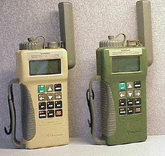
Also known as “that worthless non-functional piece of shit” by anyone who tried to use it. Heavy assed brick that more than likely would lead you into a minefield than out. Fucking hated that thing when and IF we ever even tried to use them.
So, when in doubt, fall back on old school shit that you know works. As in the compass, lensatic, magnetic, type one each:
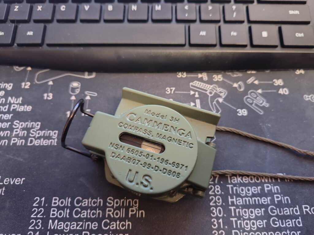
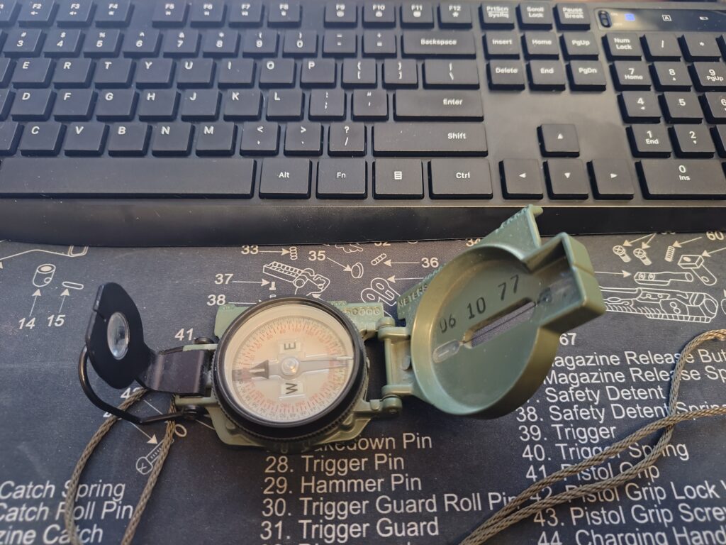
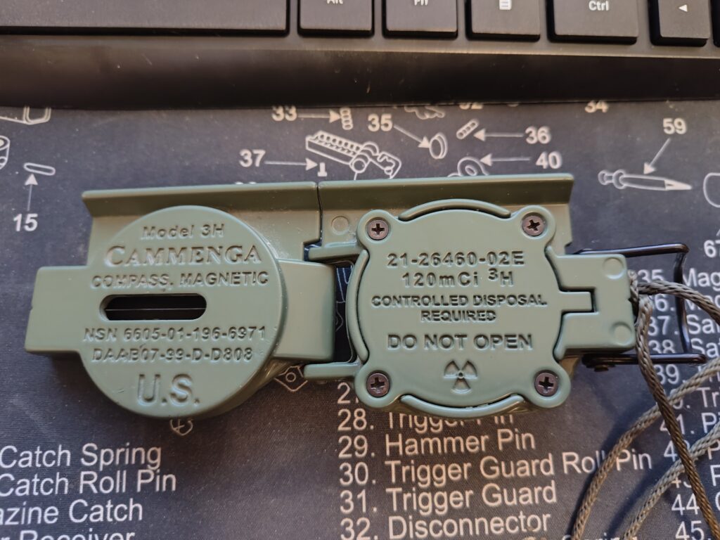
Now… this one, as you can see has the radioactive element (tritium) that keeps it glowing… very handy late at night in the rain. This’s as close to the issue one that you can get. Not sure what the pricing is, but I know when I bought mine YEARS ago, it was pricey at $50… back when $50 was $50 and a major purchase/investment. Bass Pro lists it now at $110 +/- so yeah…
Now, all well and good to have the compass, but to know how to use it and navigate by it? Definitely an different story. First off, you need a map. I got mine WITH the DotMil Military Grid Reference System marked on it. UTM / MGRS (Military Grid) allows you to use the protractor that we ALL used to have back pre-GPS:
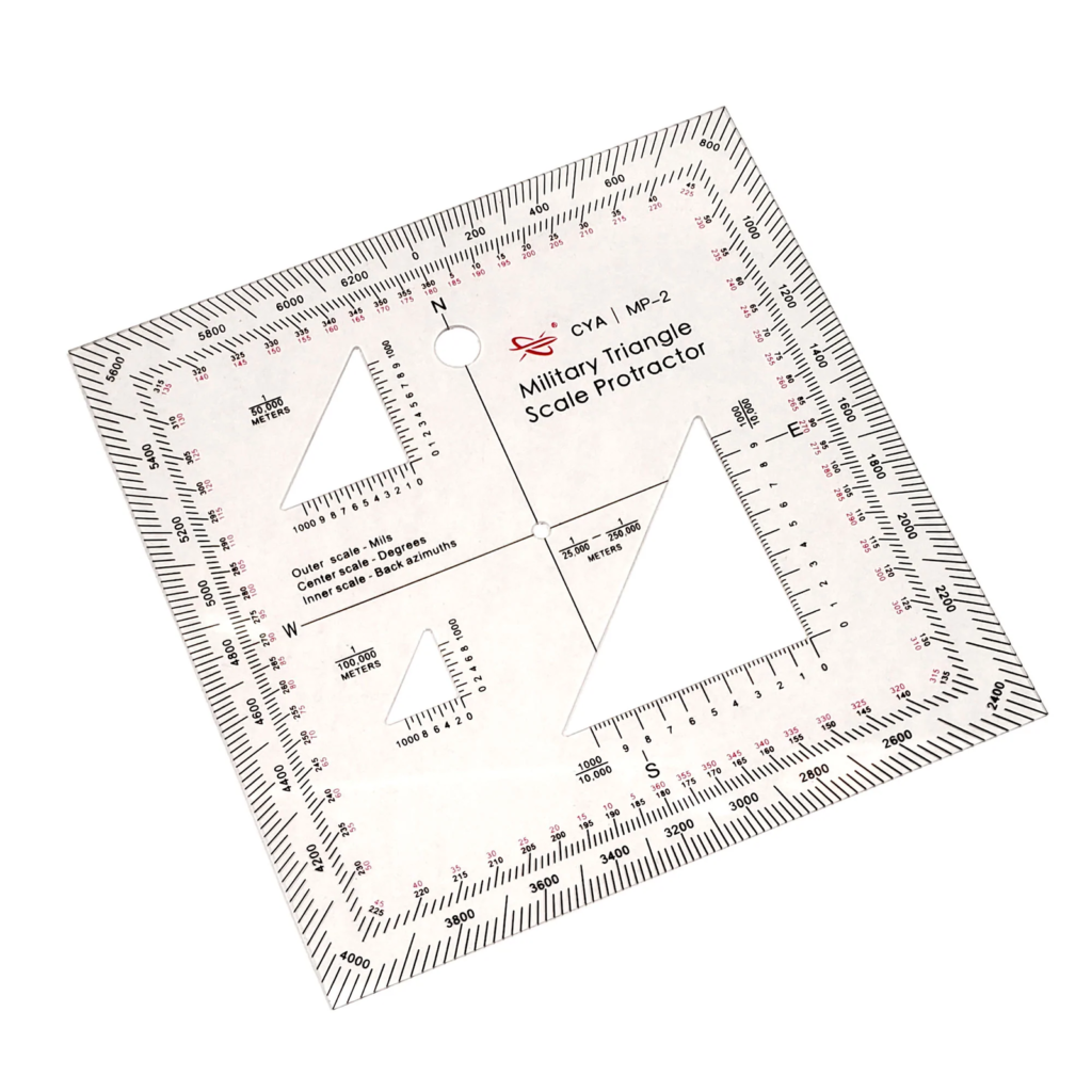
I actually have one of my original ones in my LandNav kit…
Do You?
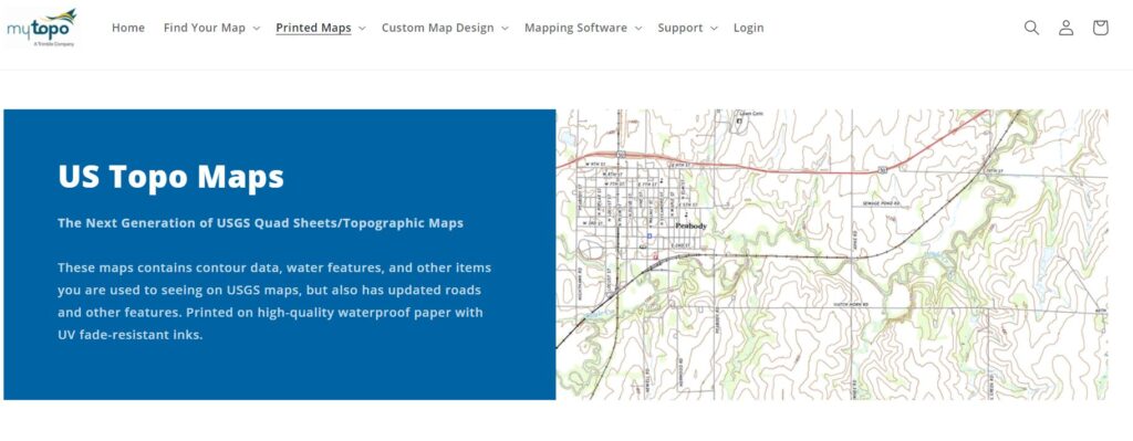
Now… for maps… I went to MyTopo dot Com. It’s where you can get ALL sorts of maps, from US Geologic Survey Maps, to sat-photos to well, a LOT of various maps, all of which yopu can get, even customizing (like I did) for your immediate Area of Operations. The link is HERE and nope, I don’t get anything for this.
Now… the map itself is LARGE. It’s waterproof (theoretically) and folds up pretty well. Problem is that personally, I don’t need a full on map of six square kilometers of my area of operations. I need a much smaller, handier Map that I can utilize in the field, and have ready to go. A mini-map board like I had back in the Army.
So what I did was I took the map, folded it down to the area I wanted, and did a high-resolution (1800dpi) scan of the area in question, and had it output to a 8.5 x 11 sized piece of paper. I then used high quality paper, and set the printer to it’s highest quality setting, and ran a copy.
Once said copy was done, (I made 2x, one for Sapper, one for me) I printed off the map scale and magnetic declination for a reference. I printed two of these as well, and cut them down to size, as it didn’t need to be a full sheet of paper. I then heated up and ran both of them, the map scale/magnetic declination and map through the laminator which produced this:


So now I have a good ‘localized’ map of my immediate Area of Operations. I’m waiting on the Zon to deliver the dry erase markers so I can add the MGRS markers, as well as ‘update’ some of the roads and whatnot, as the information that was used by the map maker (MyTopo) came from the last time they did a geo-map of the area (like try 1985!)
There are newer ones, like from 2021 for my A.O. however, they don’t have enough of MY immediate area… seems Ye Casa is in the upper right corner of the ‘new maps’, and I’d have to buy 4 of them at $16 a throw to get a fuller picture, which currently isn’t in the budget. I bought this particular one waaaay back when I first moved into the area, and only recently found it while cleaning out the closet… when I also found that optic and other ‘cool shit’ the X had stashed away.
That being said, I highly recommend that you step up and get your “map game” on. Given that shit is getting weird, it’s time to “go pro” as the good Doctor Hunter S. would say. IF the goolag maps and/or comms device you have shit the bed, are you capable/able to navigate without it?
My bet is a good 30% of people HERE would say “no” if they’re being honest. Considering the audience, I’d say 70% of you could operate sans Gizmos. But as far as the rest of the fucking Normies? They couldn’t navigate theyselves to a Chinese Clusterfuck in a Hong Kong Whorehouse if their lives depended on it.
Go Figure.
So More Later I’m Still
Big Country

I’ve a good friend who can’t even navigate their local area without GPS. Seriously, tried to meet them literally just down the road from where they live once, called them because they were late, and they’d gone in the complete opposite direction.
You’re probably far too generous to the wider population.
I was using a GPS to navigate out of the Orlando airport, as I was driving north on US 441 the Garmin told me that I was.going south, luckily I knew the area well enough to know which way I was driving. But if I didn’t I could have been seriously detoured.
Florida has lots of sun and if you don’t know the sun is in the south there is nothing that can help you.
Last time I was in Miami Cruise port the sun looked OVERHEAD to me. So not so useful as a “Southern direction marker”.
The US Geological Survey has free downloads of the entire country. Do a search for USGS topoView.
I downloaded my area in jpg and cropped it to suit my needs before printing.
I also downloaded the area around me and saved em to my phone.
Don’t even start with Topography, 90% of GP and probably 60% here won’t have a fucking clue. Most people don’t innately even know where North is. And for nav beginners, Suunto has MC/MR models that will get you where you need to be.
Speaking of ‘which way is north” –a friend of mine visited Tokyo a few years ago and panic called me asking “which way is north?” FYI–the buildings are so tall that you cannot see a horizon or any land features. This is why when I visit there I always carry a small compass with me pinned to my vest. Had to explain it to customs once why it was there–and I gave the the above reasoning, which they immediately understood with amused smiles. Anyways I told my friend (he was standing in the 5-way Shibuya crossing at the time) to face the rail road tracks–that is north… ish. My first move when I arrived in Japan was to find the highest vantage point and survey the prominent buildings and landmarks. Best place to do that now is from Tokyo Skytree which is worth the price of admission FYI. And yes–that compass highlighted by Expat is worth the price of admission also.
Word. It is because simple geography is NOT being taught in schools. And since the Boy Scouts have been taken over by Sodomites, most parents will not send their sons to that organization, which does or did teach land navigation and basic astronomy. “…men at times are masters of their fate. The fault, dear Brutus is not in the stars but in ourselves that we are mere underlings.” – H/T to Will Shakespeare. Bleib ubrig.
https://www.amazon.com/Rite-Rain-All-Weather-Copier-8511/dp/B0016H1RYE/ref=sr_1_5?keywords=waterproof%2Bpaper%2B8.5%2Bx%2B11&sr=8-5&th=1
For easy waterproof copies of your AO downloads.
Good info, don’t forget Ranger beads and knowing your pace count, with and without gear.
National Geographic has downloadable topo quads.
https://www.natgeomaps.com/trail-maps/pdf-quads
If you have one of these…or any other device that uses Tritium for night time illumination…and you haven’t used in for a long time you should get it out and check the illumination in a totally dark room or
closet. Because Tritium has a half life of only 12.3 years. That means if something has been sitting around for 25 years the illumination will be less than one quarter as strong as it was when new. So check that stuff now and repair/replace it while you can.
I was going to comment this as well. I have a wristwatch that has Tritium lume, bought in the late 1980s. It is very dim in the dark now. When I bought it I had to get a cover when using tactically, it was so bright.
I’m told that clear Thompson’s Water Seal will waterproof a chart – couple of guys I knew would treat their sailing charts with it. Said that the chart would wrinkle up when first wet with the stuff but would smooth out when dry. Still foldable and shed water. I’ve never tried it.
As you noted though, laminating it would let you mark directly on it.
A great topic.
For the uninitiated: the best way to learn orienteering is to take a class at your nearest junior college. You’ll be amazed at how easy it is to learn navigation when you don’t have an R. Lee Ermey wanna be ‘instructing’ you. A tritium compass is great, but not necessary.
GPS is also great, but never forgo paper maps. It’s like having your survival library in PDF form; When you no longer have a device to read them on, then all of your books are gone.
What dood said, x100 great comment Mah-Man LOL
I went thru 2 good printers printing everything I wanted to store in 3 ring binders.
when I worked at the VA (3rd shift) I printed out a lot of books/stuff to keep.
I found the plastic covers for paper a very good investment too. what was weird was when I was checking out for retirement, the IT guys told me how much they have learned from what I was downloading and printing off. and they told me how most people just print off sales ads and crap.
I think I converted 3-4 guys down there into thinking for themselves ?
went over map reading and all of that with the grandson last summer. he was amazed at just how easy it is to do. took maybe 2 days for him to get it down. the wife doesn’t understand why I have/keep paper maps in the truck as it has GPS in it. so, of the power goes out. I still have all of my 3ring binders full of intel on what to do and how. and all of the good/needed stuff is in plastic covers inside those binders.
That’s how I acquire and keep my maps – print out the quads and put them in sheet protectors, then in binders. Only problem is the sheet protectors aren’t waterproof.
Lamination is the only way to go for anything you’re going to be hoofing it with.
My favorite compass is the Suunto MC2 and then the M3 baseplate models, followed by the old military lensatic compass.
The old Army compass had gotten pretty dusty inside. I thought the lens had frosted up, but it was just dust. One day, I came across a youtube video by a guy who restores the old military compasses. It showed how to take apart, clean, and reassemble one. Now, my looks like new – or as new as I can get it. The tritium is long dead – won’t even hold a charge, anymore.
There are lots and lots of land nav videos on youtube. Some better than others. I’ve even learned a thing or two from some of the guys on there that I didn’t know.
iGage waterproof paper is your friend for printing maps. -Then- laminate. Belt and suspenders, plus it is then compatible with dry-erase (as many here know, -never- permanently mark up your maps for OPSEC reasons).
Did a test about ten years ago, put a couple of laminated waterproof paper maps into a crab trap, then chucked that into the bay for a year. Pulled it up, and they were just fine.
It is not actually a paper, but a printable polymer fiber matrix. Seems spendy until you think about how vital maps are, and how screwed you may be if you are in a full-immersion scenario. Works great for range cards too. Rite in the Rain isn’t bad either, but the iGage is superior from my experience.
https://weatherproofpaper.com/
For you younguns, Orienteering is Geocaching with a map and compass instead of GPS.
Kinda makes me think of the jokes they played on FNGs in my Canadian dot.mil days, where they’d get sent to thr regimental QM for a pallet of grid squares or a spool of contour line.
The only reason I didn’t fall for that shit was because I still remembered all the orienteering lessons I sat through many years back, when the Boy Scouts of Canada wasn’t a fucking joke.
Only thing I’ll add: be sure to keep the topo maps for your AO current (roughly within 3 to 5 years, usually depending on location) in order to adjust for magnetic declination changes.
Also, map tack (or laminate) and a couple of lumograph pens are a must.
I have piles of old USGS maps (1950’s-current), and sometimes the older ones are better. During the 1970’s the gov’t started deleting old roads and buildings, when you are trying to stay under the radar, hiking old forest roads from 50-100 yrs ago can be a plus. I do a lot of historical and archaeology work on our old logging days and have hiked roads that don’t show up on modern maps. They are not driveable anymore, but the path thru the woods is still there.
We spent 20 yrs clearing and riding our dirt bikes on non existent roads, sometimes riding 80-100 miles and hardly ever coming out on the new USFS/BLM roads (this is just recently, 50-80 yr olds still racing enduros).
Old school is better during survival situations, every time you turn on something electronic you are being tracked. Folks can’t get that thru their heads. I learned my stuff in the 1960-70’s and will stick with it.
Good point on the old maps, which is why archiving these is not a bad idea. After all, that’s more or less why the dot.gov also archives old maps. They’re great to use for reference on, as you say, old trails, landmarks, etc and you can use them in tandem with updated maps. It sounds like you’re one of those guys who knows your old stomping grounds like the back of your hand, so a map/compass would really more of something you’d use to confirm things you already know anyway.
Even still, I wouldn’t eschew the new maps in favor of the old maps for the reason I stated above (changes in ‘magnetic north’/magnetic declination) especially if I’m working with people who aren’t familiar with the AO as I may be, are developing land nav skills, or even if there has been significant changes to the landscape. I’m pretty sure I’m not saying anything anyone who isn’t a ‘butter bar’ doesn’t know when I say that even a 2 degree shift in magnetic declination could put a guy significantly off course. If the destination is a significant distance from your start point, you could find yourself several miles off your mark – a mistake that could cost one their ass.
I have taken the newer series of maps and overlaid them on the older ones, then traced the old roads onto the new ones with the aid of a glass plate and light underneath. That way you can have your old and new info, including your new declination diagram.
My father was a cartoonist at WB in the 50-60’s and they used a circular rotating glass to copy the previous image and I have a drafting degree, so I have always had a large framed plate of glass for drafting and copying. Very simple old school technique.
I use old map overlays to find ghost towns and old mine sites to explore.
For those in AB they used to sell mapbooks of the province for oilfield workers. 150 pages, spural bound that showed every well, facility and every road and lease access trail plus pipeline cut lines. The last non-online edition was 2015ish. If you can find one they are amazing for finding ways around that dont follow roads or that have routes even locals often dont use.
Plotted out all exits along swift moving creek and practiced with light load.
OBrandon is out to burn out all down once and for all and Mad Max world isn’t fine but there was no vote on it.
Time to practice with a heavy pack, lived in this area since early 1980’s, grew up here, know it even at night from woods travel off now dangerous overcrowded two lane roads and Johnny Law avoidance.
We camped out and partied all night on weekends in what is now subdivision sectors.
New Jacks and CPUSA transplants are working hard on the Fundamental Transformation and will turn in a Patriot American for an EBT card when it gets fugly.
Fuck all that depop clot shot horseshit and just read that OBrandon is going to ask for $40 million from congress and “recommend” that everything get the experimental gene therapy.
Big Country you covered maps and orienteering with lensatic compass well. Some good reminders.
But you left me hanging about Area Studies. From my AO, it’s knowing how to get around road troubles secondary road knowledge and such, requires a sense of direction or knowledge of where’s North for example.
In less civilized times (mostly peaceful protests anybody) knowing secondary options is critical. Also, AO Studies in my experience needs to include social studies as in where NOT to be travelling through spicy times or not. Various sources include buying coffee for your Sherriff neighbor and BS’ing a bit, various sites like https://spotcrime.com/ and such.
A short cut or bypass that puts you in the middle of the Hood as the filling of an Oreo isn’t clever.
Advanced sporky times Area Studies should include off road passages like train tracks, trails, where fences you need to cut or climb over, sources of safe water, local food sources like in New England where Apple trees and such are. Notes of places the local Methheads do their thing and such.
Knowing were assets that would put you up for the night and areas where they have “Support Ukraine” signage and will call the po-po on you in a New York minute seems useful.
I’m sure you could do an urban-semi-rural article about this subject. Or start a thread?
Some good points, Sir!
As a delivery driver, knowing the back alleys was huge. I can park over here and walk the delivery over… that trick saved me hours. I teach my kids the benefit of secondary routes and ‘parking to exit’ at events and such. They see it now, Dad always gets home faster…
Nobody thinks life is ever going to change from what it is now, though. Thats the hard part.
Good stuff. As it’s said, “back in the day”, I used gallon ziplock bags for my maps. I’d fold them to fit. Worked surprisingly well, although the comments show much improved techniques. Love the rite in the rain printer paper! And, I still have 4 “square circles”. 😉
If you’re in AAA auto club you can order.paper maps.delivered right into your mailbox for no extra cost.. I order new Florida maps every year and if I’m even thinking about going somewhere I get the paper.maps of the area.
Also, I’m not sure if it’s a state wide option, but in my county property assessor office you can buy aero maps of your region. Or download them from their website.
Regarding where to get topo maps, I like and recommend caltopo.com
You can print maps at any magnification level, centered at any point you want (like your house or wherever).
You can also select which layer you want displayed on the map, ie topo, satellite imagery, a blend of those, there are quite a few in there.
Just like the USGS maps, they are printed with a scale and the magnetic declination on the border. You can also select when you print if you want UTM, Lat/Long, or both printed on the coordinate scales.
Caltopo can be used for free without registering or paying, although the free version limits you to 200 dpi when you print. For $50 a year, you can print at higher resolutions.
I ain’t going nowhere, too old. For the younguns I hope you are in shape or you won’t be going either, at least not far. While you are learning to land Nav. Be doing some rocking. God speed to all.
I was a topo map studier and terrain association navigator when I was just a kid growing up in the country. The Army refined all of that, but it took me a long time to get smart on the LandNav courses by finding an unmistakable feature like a cemetery near an objective and simply walking the road to it instead of dead reckoning through the bush. I would figure an azimuth from the cemetery to the objective that was much shorter then the long dead reckon from the start point. Until I figured this out, I was always amazed that some of the smarter guys always finished the landnav course before everyone else, had no errors, and somehow were not sweat soaked, thorn scratched, and wet up to the waist like everyone else. I always thought a challenging compass course should involve dropping the students of at an unknown remote start point and forcing them to figure out where they were from either terrain association or calculating intersecting backazimuths off of 2 or more distant terrain features before they could even start working on the first objective.
*face-palms* Yeah, I have some very un-fond, post-active service memories of a douchebag O3 taking bearings under power lines at Fort McGoo, WI while wearing his steel pot helmet, then posturinging heroically: “This way, men!”
OK, Bwana …
Later that night, whistling sounds overhead, followed by loud ka-booms nearby.
Early the next AM, Range Control helicoptered in, wildly gesticulating and jibbering like rabid baboons: “Do you assholes know that you have bivouacked inside the edge of an artillery impact zone?”
Cap’n Crunch, of course, pointed his soft, stubby little finger at Top …
Also consider Cal Topo.
https://caltopo.com/map.html#
Should be able to get your MGRS overlay on there.
For waterproofing maps without using really thick covering, I use clear contact paper that comes in 18″x24′ rolls. Learnt this waaaay back when I was in the green machine. The issue maps did not come in any kind of waterproofing, so we had to do for ourselves.
As for the 2nd Lt. They are the most useless things in the universe.
This is not a new problem. Back in about 97 or so my unit was at NTC. We had 2 Lts who insisited on using GPS and/or the Plugger without ever looking at a map. I was an old school SSG, didn’t use the electronic crap. The Cpt finally had enough and sent me and the 2 Lts on a recon mission to no where. Told me to run around the points he had assigned them until the batteries died. 8 hours later signals had faded to black and I headed to the last point. I was using a paper map the whole time and they were amazed that I could just look around and head straight for our last point. Once up on the hill they were delighted to find a signal…for about a half hour…while I ate and napped. Once they things were dead I pulled out the map and began to teach how to read a map. The first thing I did was show them how to orientate the map to the ground we were sitting on and how to read the terrain. after a couple of hours they had a basic idea of map reading, how to use a compass and grid. When I teach map reading it is always how to find where you are on the map without tools first. My oldest while in the Marines out in the Mohave found it useful when his mortar section got lost in a sand storm and had to wait till morning to find out where they were. Compasses and protractors should be taught after learning how to read the map.
97 was quite a while ago in contemporary terms. Am I to understand you could be commissioned as a 2LT through OCS/ROTC/USMA in that era and not have demonstrated practical efficiency with map, compass, and protractor? 15 years before that it was a foundation skill in any of the commissioning pipelines above and was trained on frequently. inability to pass map reading and land navigation would get you out of any commissioning program just as quickly as being fat or misbehavior. We did not have the electronic doodads mentioned above at all, so that was not an option. Those skills had to be maintained and built upon post commissioning as you simply could not function in the field otherwise. More advanced skills like call for fire were predicated upon strong Landnav skills and the tolerances for close but not close enough were very high.
If the military cast aside the old hard skills like this that long ago, then the rot has got to be fatal by this point. It is clear that there are few if any woodsmen in the land forces or true seamen in the Navy. The results ought to be epic when the balloon goes up again.
NOLS (National Outdoor Leadership School) is based out of Lander WY, they are totally leftist /enviromentally oriented, have schools all around the globe and now teach the US Navy sailing skills, how the hell that happened is beyond me, but I guess it’s all part of the new private contractor business.
In my day 50+ yrs ago it was the old SNCO’s and senior chiefs who taught the young recruits how to stay alive, we now learn from 20-25 yr old environazis who grew up in the cities and attended a few NOLS courses, a complete and total recipe for disaster, as planned.
I’ve been around these folks for about a decade, they are brainwashed beyond help (blue hair, dreds, tats and body piercings, etc) and truly believe the only way is their way. I don’t doubt many of them are Antifa also.
The first thing Ivan or Wang will do when the balloon goes up is take out the GPS satellites.
Unfortunately, you are probably correct. Multiple EMP’s will take out ‘orbital’ hardware like GPS or comms (unless extremely well hardened) just like it’ll also take out the power grid and any modern (post 50ish) electronics. If someone wants to cripple us so we can be invaded/subjugated, all they’d need to do is wait about a year or so – so that about 80% of the existing population would have died off due to starvation and illnesses that today are mere inconveniences.
THIS is the scenario I’d be planning for: how to live completely off grid and with NO modern conveniences (like – imagine instant 1820, and no running water or sewer services). Life is going to get a whole lot harder, and obesity will no longer be an ongoing problem.
How many of you all can find north by the stars. All my grandkids can. Always good to have a backup
There are some other resources with GIS mapping…
https://libguides.mit.edu/gis/world
An example of a county resource:
https://beacon.schneidercorp.com/Application.aspx?AppID=909&LayerID=17429&PageTypeID=1&PageID=7822#
Check your local city/county “land office” and you will discover a major resource. Also, think “specialty maps” such as underground sewer, storm drain, electrical, etc. The State level (Dept of Transportation usually) also has tons of road data and mapping info – don’t forget the fish and game folks – trail maps, parks, etc. that may also be of interest.
This is a great post and something most people don’t think about. Very few jung folk know which way is north or how to follow directions using the cardinal directions (most people my age don’t either). I try to always map out a route to a place I am unfamiliar with before I even plug the directions into Screwgle Maps, as even in 2023 the mapping software will often take you some squirrelly route to save the environment or something.
Go out and use your map and compass – at night. Where I live is a 2100 acre Greenway. Technically its trespassing after dark but I won’t get shot stumbling into someone’s back yard. Practice light discipline and I haven’t got caught yet. I used to ruck walk on the roads at night but got tired of hassle from the local bored pops (small town). Hence, the Greenway
Popos (spellcheck)
Spyglass app is pretty good while the world is still “functioning”.
In the even of the above mentioned EMP scenario – just be sure that you’ve downloaded all the maps you’re ever going to need, and that you’ve got a EMP proof container for your smartphone. And a solar charger for it. 😉
Does anyone remember how to do an “Austrailian Fold” for maps? When at Mother Rucker in the late 80’s, I had a small but profitable buisness making low level tactical maps for other UH-1 and Blackhawk students. Then the TACs shut me down. I thought for sure that I would never forget how to do it. BUUUUT….well it has been 30+ years. I did try Giggle, but no joy. Anybody?….Buehler?
Yup. Used them all the time. Opens the map up to saturation if you don’t reseal the edges. Used to use clear packing tape to seal mine. Great for navigating, especially in a vehicle.
Here’s my shitty attempt at directions sans photos:
Fold the map into 6 even sections from North to South.
Fold the map into 6 even sections from East to West.
Center four squares are the base square of your map.
Starting from the west edge of the map, count 2x creases in and slit the map from the northernmost crease to the southernmost crease. Repeat, instead starting from the East.
Accordion fold your map starting in the north. First fold should fold toward you.
Open to the center, accordion fold the east edge toward the center, then the whole eastern side to the back. Repeat for the west. Secure the back with tape or whatever you prefer.
Hope this helps Dindoo. If BCE is interested, I could try to provide some photos/video for a wider tutorial. Might make some decent fodder for his substack.
Sarin
The scary thing is that many people in the .mil and civ street all believe that the Internet can NEVER go down and GPS and all of the electronics could stop working in a war or crisis.
When you say “If I was Russia, the first thing that I would do is start popping off EMP weapons over the battlefield”.
Most will then say “well if Putin pops a nuke then it’s game over”.
You then tell them “you do know there are non-nuke EMP weapons out there” ?
Their response is a perplexed look.
I would hope and pray that the .mil still teaches orienteering but something tells me they don’t.
Can you imagine an Army arty unit today hit with an EMP ? Could they get any ordnance where it was supposed to go ?
Actually, the Bear is already seriously Degrading/Jamming the GPS all over the ‘Kraine. The “Tirada” Jammer is in a Radio Van on a 5-Ton 6×6 and it not only can be set to ‘Blank Out’ the GPS signal, but Distort it (that’s called Meaconing in Aviation) and then the Nazi Cruise Missiles, Drones and Guided Art’y Rounds go Somewhere Else than what they are Aimed at.
Having the Geosurvey Topographic Maps is essential if you think you might have to “Hoof it” overland, as being able to pick a Route that avoids steep Terrain changes can often be more valuable in terms of Effort needed to Travel versus a longer Distance. And Older Maps are still Good, as they often show Topographic Features like abandoned Trails and Rail Lines that ‘modern’ Maps don’t.
I’ll admit to the navigational sense of a ferret. Therefore, for now I have the car-nav, paper maps, and road signs. I did not know that the local junior colleges taught land navigation, so I will check out a class. When the balloon goes up, I acknowledge that landmarks, road signs, and safe passage all goes away, so I need some training quick! Back alleys, circling streets, and such make it very easy to get somewhere faster and those will change too. Great article.
Can you imagine ‘somebody’ trained in moving and switching road-signs…
… the new routes designed by the criminally-minded to facilitate high-jacking, kidnapping, and other nefarious activities.
If you are near a large-ish city there may be an REI store. They have expensive over the top gear for the seriously well off but have some stuff worthwhile for a peasant like me so I stop now and again. Yup, they are a big bunch of left leaning tree huggers like you wouldn’t believe but – they do run some very good basic courses and may be worth checking out. Sort of like being undercover so if you go be real civilian like and drink some foo-foo energy stuff and you will fit right in!
REI’s like 5.11 Tactical for city leftists who are afraid of military surplus shops and who want all of their kit to be colour-coordinated. 🙂
Hey Bud,
BCE said you weren’t dead in the water. Glad you’re
still the indian not the arrow. He knows where to find
me if you want to connect.
Keep in mind should you be in an area that there is logging going on that there may be a shit ton of new dirt roads not on maps. Found this out running around Grafenwoer and Hohenfels Germany.
Great content and comments. I’ll just add that if you are talking about your own grid square, what I write next won’t matter to you. If you don’t know what I mean by “grid square,” just skip this.
That said, compass Variation, Deviation, and Declination are NOT the same things. I don’t plan to give a class here, because 96% of you won’t give a shit or need to know. For most, and I say this in a loving way, “the sun rises in the east” will be enough. And God bless and protect you and yours.
But if you are doing longer range navigation, in a plane or in a boat, 5 or 10 degrees of error from not understanding Variation, Declination and Deviation can mean you missed your island, (Amelia Earhart, say) or you landed your B-17 in the Sahara and died, instead of landing at our WW2 base in Tripoli, Libya. A ten degrees this or that way error over 100s of miles can kill you.
IOW, of you are doing this compass work for 100s of miles, and not just counting Ranger paces in your AO, this will matter. If you don’t navigate by the 100s of miles, just have a laugh, who gives a shit, I totally understand. But the B-17 crews and Amelia Earhart found it less than funny how these 10* Variation/Deviation/Declination errors can stack up over 100s of miles. Then you run out of fuel or you run onto a reef and you die.
But Matt, some of us travel for a living. Me, the entire SE, from FL where you live to VA to TN to AL and ere where in between. Am I delusional thinking I will walk home from Tampa to where I live in SC. Maybe, but what, should just sit in the airport waiting for it to get better? Heres an idea. Carry 5 gold ozs in your GHB and flag down an ambulance driver to drive you home. That’s a steep Uber fare but at least I get home to my wife and kids.
That’s a great idea but the ambulance will probably be stuck in gridlock and looted.
True. Yet I still have a job. I still have to travel. Maybe I should just curl into a ball when the world comes to an end. Or maybe steal a squad car and I can run the lights and sirens. Bottom line, I WILL get home to my wife, my kids and my invalid mother. Why because they look to me as their Tactical Wisdom knight and on judgement day Jesus will hold me accountable. Everybody on all these freefor blogs grok and bitch and moan about the keyboard warriors. I have a God ordained duty to protect kith and kin and by GOD I will, come hell or the afterlife.
Recently picked up two new lensatic compasses to go with the 60 year old one I still have from scouts.
The stupid people around here can’t even navigate WITH a GPS. Our street runs parallel adjacent to a major highway. Lots of stupid people hear the turn now and turn on our dead end street instead of 25 feet later onto the access ramp for the highway.
Several of the ones that come down my street are too stupid to stop when the pavement, houses, and streetlights run out and end up driving into the woods and getting stuck. That includes a friend of one of my granddaughters who was bringing her her to drop off something for her grandmother. Real genius there. They keep going because the GPS says to keep going. The original plat maps for the neighborhood from 60 years ago show my street continuing for a quarter mile farther than it actually goes. Some of the GPS maps show this old incorrect data.
“… and magnetic declination …”
Han here has lived in a few places with wildly different magnetic declination, and it’s interesting to see how many people get lost.
One place had over 20 degrees magnetic declination, and people who eventually got found said they kept going in circles where they’d come back to their origin point within an hour or two.
That’s enough to know that you’re doing something stupid with a compass, so maybe you’ll stop doing that.
Another place had only 6 degrees magnetic declination, and people who got lost often would stay lost for days or arrive in a completely unexpected location. This wasn’t bad if they lucked on some farmer’s house out in the middle of nowhere, but if they were in the mountains, that could get dangerous pretty quickly.
Then there’s the place with almost exactly zero magnetic declination.
People still got lost because they didn’t know how to use a compass or how to read a map.
Everyone else appeared to get to where they were going.
For every occasion, there’s a level of ignorance well-suited toward it.
“Oh, that old military compass looks so cool, it even has a star on the dial … hey, why’s the needle sticking?”
Don’t tell ’em, it’s more fun that way.
Off topic…. did anyone else’s gab account get wiped?
I’m still good…
My earler comment wasn’t accepted so I will double down It is pouring rain in my AO. I am literally making this comment in the greenway to which I referred earlier, in the rain with just compass and map. Why? Because I’m not a LARPER. 61 years old, no knee cartilage, sucking it up because landnav is easy when its daylight and pleasant weather. If you are not practicing your skills when its hard- you are wrong. Yes, I have a day job and need to leave 0600 in the AM. But I will walk my cripple ass out of these woods and then walk the two miles home. Does my wife think I am touched? Yea, so what, at least I have done all I can RE my God ordained duty to protect her. Get hard, tempus fugit.
Damn, now I feel like a d*ck. My earlier comment popped up just now. Whatever, the rain is at least letting up. Oh shit, I see flashlights, gotta bounce.
https://ngmdb.usgs.gov/topoview/viewer/#4/40.01/-100.06
Access free downloadable USGS topographic maps from the present day back to the late 1800s at least. The have them in adobe .pdf GEOreferenced PDFformat, google earth .KML file format, .JPG JPEG image file format, and GEOTIFF file formats.
You can download a bunch of the KML files for your AO and view them OFFLINE in Google Earth. There are no borders, scale markings, or any visible edges where two or more maps are viewed in Google Earth.
I’m pretty sure you can download at least one of the available file formats into ATAK for whatever uses your diabolical little minds can come up with as well.
Here I am always late to the party.
Concerning declination, this is an abbreviated excerpt from a course I shared over on wirecutters blog a few years or more ago. I authored the course for our kids back when we were homeschooling them and needed a course curriculum to give to the local indoctrination center.
The following caveats should be noted: This will work for any map regardless how old it is; You don’t have access to the web to look up the current declination; You are physically in the area you want to determine the current declination for. This is North America centric and has only been field tested here.
Ensure you are in an area or location where environmental factors or gear are not able to affect the function of your compass.
Turn your compass dial so zero lines up with the index line.
If your compass has adjustable declination ignore it for now.
Pick out a landmark or other object directly true north of your position. An even better alternative is to use a road heading due north of your position. Note: Other directions will work but it is easiest for most folks to just use true north.
Orient your map to match the terrain.
Place your compass on your map so the grid lines in the base of the dial lines up with the grid north lines on the map.
Your compass needle will now pointing to magnetic north. The degrees reading is the declination for the area you are in. Whether it points to the east or west of zero and the index line will be determined by whether you are east or west of the agonic line. Depending on your compass and how careful you are you should be able to come within a half degree of the actual declination. This is certainly close enough for most local area land nav. You can now use this value to set the declination in your compass or use the value in your bearings.
wes
wtdb
I for one would appreciate a post or series on land nav, and other topics. You have a straightforward way of writing that is easy to comprehend.
Maybe a series for your Substack? Or YouTube, if you decide to start that again.
Be sure to add marker overlay for 5G towers and traffic cameras
Prior to departure, pilots stop the aircraft at the junction of the taxi-way and the run-way.
This ‘run-up’ area has a compass-rose painted onto the pavement.
a — the flight-crew adjusts the old-style mechanical compass (required by FAA) to compensate for declination.
b — all eyes scan for a clear run-way and zero-zero-zero in-bound traffic
c — the radio operator announces their intentions to enter the run-way for take-off.
.
The pertinent part:
* your local hobby airstrip probably has somebody willing to demonstrate adjusting the compass to compensate for declination (deviation from north).
Slip your educator a twenty to defray expenses.
I grew up in Central Africa, Northern Rhodesia now Zambia. Every weekend I went into the bush with my friends on overnight hunting trips. We learned how to navigate the hard way, by getting lost in a million acres of trackless wilderness. Didn’t take us long to use the sun and a Boy-Scout’s compass to enable us to track an animal, shoot and butcher it and later just head straight for home. Like I said, The Hard Way!
try living in the same AO for 67 years then moving to somewhere where everything feels backasswards…
i get up in the morning and i ask myself wtf is the sun doing in the “south” ?
yeah i’m still doing it after 5 years here and its infuriating all the subconscious landmarks are fuxxored…
So BCE. I commented tangetially about getting out and doing vs keypounding. No offense, your keypounding is both hilarious and effavacsious. Yet, I am sitting just now on the perimeter of the vaunted Greenway to which I waxed poetically in a previous post about getting hard. Yet, there are 500 people at this local small big name concert (Steep Canyon Rangers). So, there for the dedicated fedbois I just outed myself. (Well f*km, I am a restless sleeper.) I see lots of nice faces, some I know for the last 17 years I have lived in this little slice of upstate Carolina heavan. But dude, what strikes me is how many of these nice old or middle aged f*cks I will have to shoot in the face as collaborators to Leviathan. Its not an abstract exercise. They are sitting in a camp chair right next to me yet 6 mos from now I could be sticking a shiv in them 3rd rib down. In and up. What is so whacked is my wife of 40 years is sitting right next to me and she may need to be the first to go in the upcoming unpleasantness. Oh for the FebBois this is the context of a new novel a la Matt Bracken. Any association with real people like my beloved wife are circumstantial at best so leave my front and beautiful windows alone fuckers.
Oh and to the droogs and droogetts. Scallywag Tactical. Look up the dagger. I have the aluminum dagger. Siingle use non-corrosive. I also have the MDV II. Designed by Michael don Vito, a very, very serious knife. I suggest you check out their $13/mo knife and gun videos. I dont get shit from sending you their way other than good Scottish Highlander juju. Check out The Tactical Hermits latest on 22 ways to be a knight. I give you this so you will be a knight to no more than a 15 mile radius from your home. Get hard mofos, tempu fugit.
I am not sure if this is the correct thread to continue the discussion but so what. So I have been LARPing on these threads for a decade. American Partisan, Captains Journal, Comm Dan, yadda yadda yadda. Do I have comms?. Yes, ICOM F3S, V8, even Motorola PTP handsets that are “encrypted”
Am I the comms guy, hell no. I am a ME with a machinist and hydraulic background. I met my comms officer tonight. He is a simple red neck witg a very expensive drone for his station in life. Dont care we stood there and watched the night time feed from his drone. Beeutiful for when the dindus come south from Charlotte.
I was expecting this dude to come to neighborhood sporky time with a weedeater and he showed up with a serious force multiplier. Above 250 feet AGL, silent.
My point, I live a great little rednexk small town. Dont misjudge what your neighbors bring to sporky time.